Know the Island
Discover Culebra's Neighborhoods & Sectors
Discover how Culebra is organized and get to know the communities, sectors, and areas that shape everyday island life.
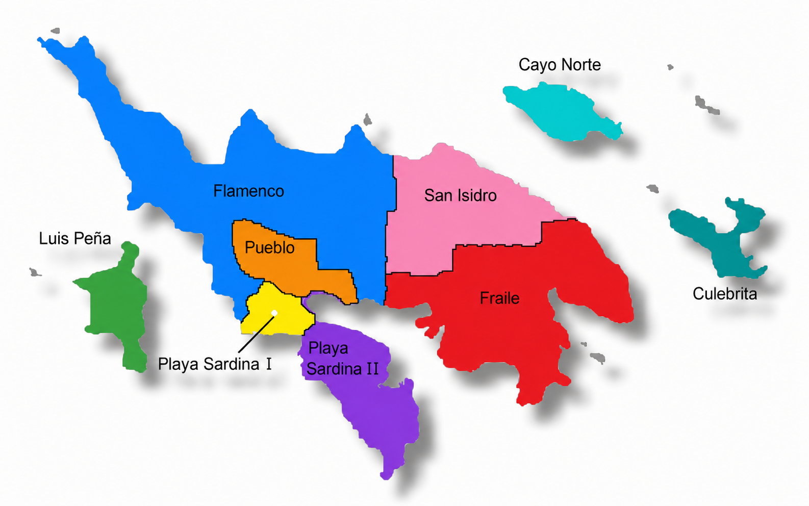
One island, many communities
Culebra is much more than beaches. Its neighborhoods, sectors, and communities are part of the island's identity, history, and everyday life. This section helps you better understand how Culebra is organized, what makes each area unique, and what you can find there from a local perspective.
How to read this section
In this guide, the barrios and sectors of Culebra are presented as we who live on the island know, identify and name them locally.
These references do not necessarily match exactly with the official divisions used by the United States Census, administrative maps, or other government agencies. In Culebra, some sectors have names, boundaries and references that have been used for generations and that are part of the everyday way residents describe our community.
For that reason, this section primarily follows the lived geography of Culebra: the names and areas that a Culebra resident would use to explain where a place is located, where a sector begins, or how a community is recognized.
The purpose is not to redefine official boundaries, but to help you understand Culebra as we know it locally.